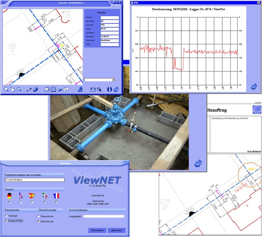
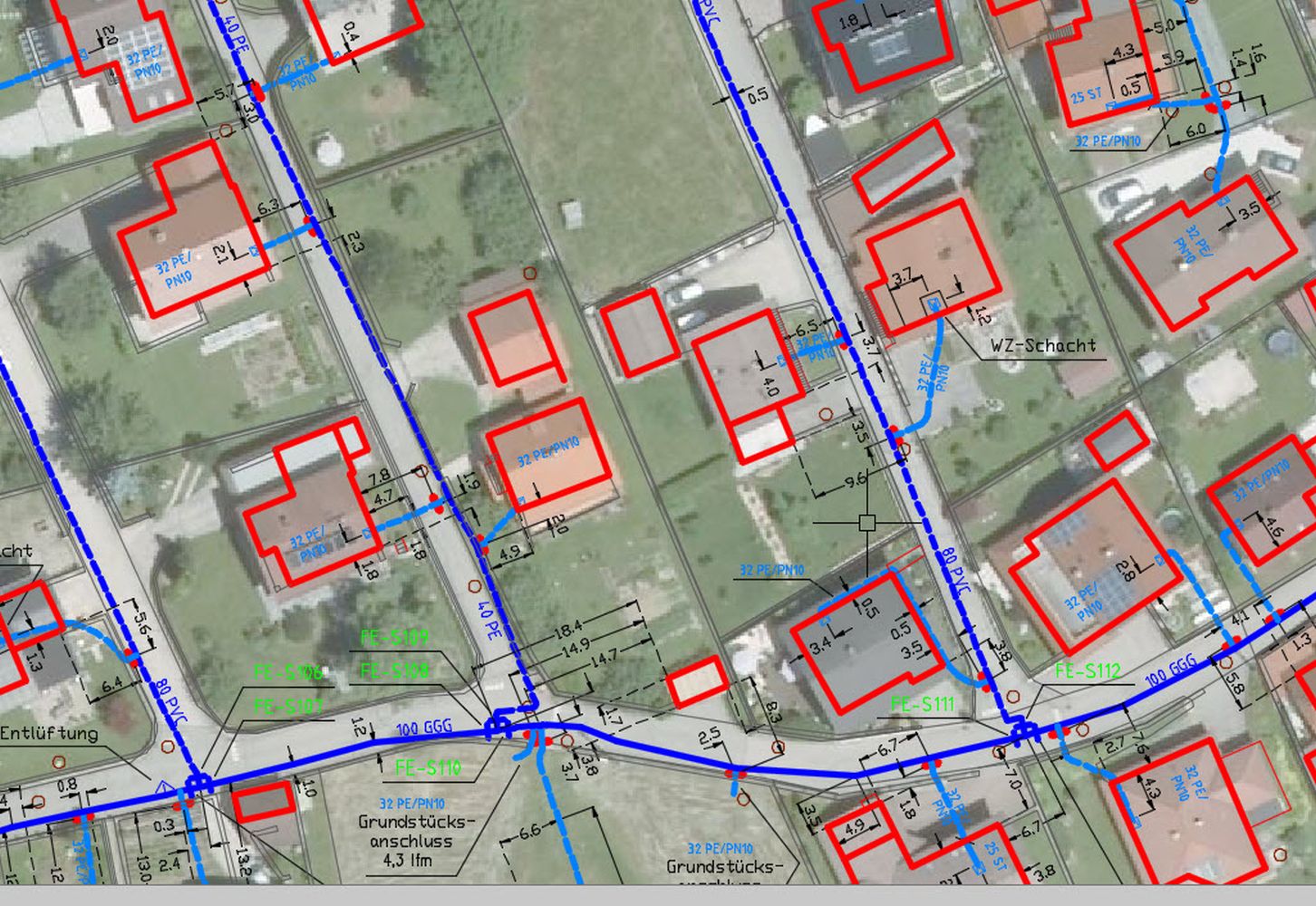
The GIS Viewer provides quick and easy access to accurate, graphically recorded infrastructure data. The associated object-related data is available in a connected database.
The viewer offers an easy, low-cost way to make your as-built plans of supply networks and other systems available digitally to all users.
The viewer supports both you and your field employees. It can retrieve and display maintenance information. Information can be stored directly in the system and forwarded to the responsible department for further processing with “Redlining” and the “MediaManager”.
- Quick and efficient output of plan information.
- Measuring functionality includes an easy function for measuring distances.
- Redlining – for easily creating your own geometries.
- Easy creation of logs for maintenance work or sketches for newly laid pipelines.
- Field employees have constant access to all plans and data (notebook, tablet).
- Transfer of query results (graphic and object-related data to Office products).
Contact: